Manhasset Harbor was a pleasure to visit. On the last night we took a water taxi to Manhasset Bay Yacht Club where we were graciously welcomed for a delightful dinner. Squalls moved in from the south as we overlooked the harbor. Fearing that the hatches were open on Kailoa, we hurriedly closed out the check and called for a return ride. Our driver speed as fast as the launch could go to get as back just as the skies opened.
Our planned departure to Sandy Hook was Saturday July 6 th . The travel plan was to
follow the East River to the Verrazzano Narrows Bridge and make a beeline in the light
wind for the Hook. The East River flows southwest bisecting the Upper East Side of NY
City and Manhattan from Queens and Brooklyn. What makes this route tricky is the
changes in width of the river which impact the current at any given point. The narrowest point is called “Hell Gate” where the East and Harlem Rivers join.
During peak tidal flow in the East River, a sailboat cannot make headway when traveling against the current, so timing is everything. After consulting Eldridge Tide and Pilot Book we calculated that the currents at Hell Gate turn southwest around 12:00 Noon. It is about 12 NM from Manhasset Harbor to Hell Gate. By Departing from Manhasset around 11AM we would arrive at the Hell Gate Bridge around 12:30 PM, with the current well in our favor.
Highly urbanized is an understatement for the East River. It was hard to take in the
myriad before us, liquified natural gas tankers, barges, container ships (both fully loaded and empty), ferries, sightseeing vessels, pleasure craft, helicopters, planes. All manner of people traveling via mass transit, sky tram, cars, walking, jogging, or biking along the shores. We envisioned the TV show “Law and Order” as we passed the ominous Rikers Island shrouded in barbed wire. We saw the United Nations Building, Empire State Building, and World Trade Tower to name a few.

Most notable were THE BRIDGES that connected the land on either side of the river, eight (8) in all. Kailoa’s mast at 67.5 ft tall easily reaching 70ft when you count the wind
indicator and VHF antenna. First Throgs Neck (138 ft), followed by Bronx Whitestone
(129 ft), Hell Gate (134 ft), R.F. Kennedy (138 ft), Williamsburg (133 ft), Manhattan 134
ft), Brooklyn (127 ft), and last the Verrazzano (229 ft).

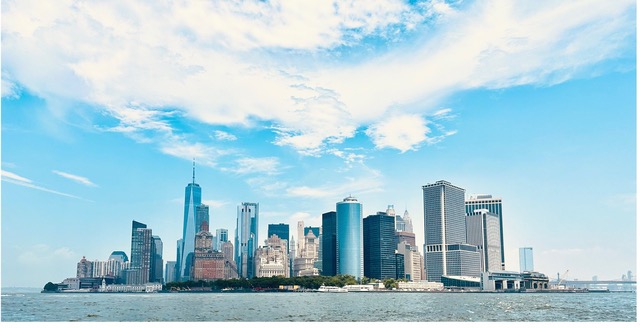
The passage through the East River culminated with a view of the Manhattan skyline as
we joined the other boats to take in the view of the Lady Liberty inspirationally standing resolute as our countries symbol of Freedom. We could have lingered longer but turned southeast toward the Verrazzano and Sandy Hook.

We were easily on our mooring at Sandy Hook by 3 PM. As we reflected on the day we
were astonished at how quickly the 16-mile journey through the river went (Total trip 35 NM). Traveling at 11 knots at times in the current, we were through in less than 2 hours. Although we are missing Ellie, we had our moment of gratitude as we recalled all it took to land here and how truly blessed, we are to be experiencing this moment together, at this time, in this place…

The night capped off watching the glorious sunset over the NJ skyline through driving
rainfall in harmony with mother nature!

HOLD FAST!


Leave a Reply